
Cities are showing an increasing willingness to implement energy-saving plans. Integrated energy and GHG scenario mapping tools can support cities in this attempt. They can help to reduce energy consumption, maximize energy efficiency, and achieve science-based emission reduction targets. Mapping energy and gas consumption and determining energy demands, for example, helps to optimize energy supply systems. This can be done using Geographic Information System (GIS) as a helpful tool, such as in the case of Glasgow. In other cases, combining energy consumption mapping with the mapping of the state of the city’s buildings can help to assess potential energy savings.
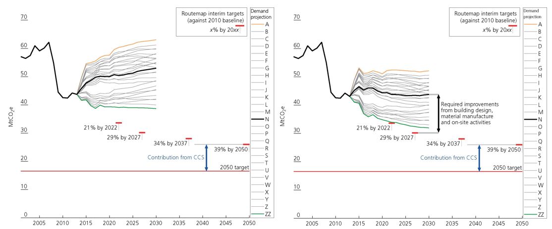
Source: Scenario analysis of embodied greenhouse gas emissions in UK construction (https://doi.org/10.1680/jensu.16.00020)
Next to using GIS as a mapping tool, other tools can help cities to assess integrated energy and GHG scenarios, define a strategy, and answer operational questions (number, age, energy consumption and GHGs impact, etc.) of buildings to renovate to achieve carbon neutrality. LEAP, for example, is a scenario-based modelling tool for energy policy analysis and climate change mitigation assessment, which can help governments to track energy consumption, production and resource extraction in all sectors of an economy. Another tool, EnergyPLAN, conducts advanced analyses of energy systems by simulating their operations on an hourly basis.
Коментари ()